- +977 9851074270
- info@mountainramadventures.com

Detail About Island Peak Climbing
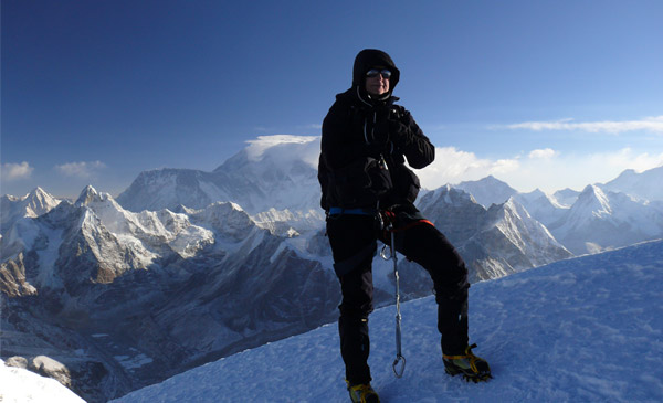
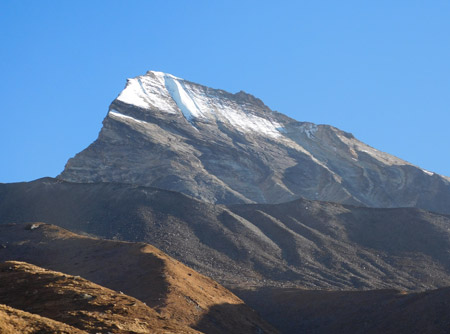
The Island Peak Climbing is an interesting expedition opportunity for everyone who wants to try high altitude mountaineering without decades of prior technical experience in climbing in the high mountains. It is located at an altitude of 6,189 meters and offers great views of Lhotse, Nuptse, Makalu and the surrounding Himalayan landscape, with the Khumbu glacier visible far below. This adventure is a blend of traditional Everest region trek, glacier travel, basic rope skills and a difficult summit climb. With the guidance of experienced Sherpa mountaineers, and a well-planned acclimatization itinerary, the ascent is designed to gain confidence and skills, and to reach one of the most rewarding trekking peaks in Nepal,Imja Tse.
Island Peak Climbing Highlights
- Reach the 6,189m summit of Island Peak (Imja Tse)
- Scenic flight from Kathmandu to Lukla
- Trek through the famous Sherpa settlements of the Khumbu region
- Cross suspension bridges over the Dudh Koshi River
- Spend an acclimatization day in Namche Bazaar
- Hike to the Everest View Hotel for acclimatization and Himalayan views
- Continue through Tengboche, Pangboche, and Dingboche
- Acclimatize in Dingboche with a hike toward Nagarjun Hill
- Explore the dramatic Chukung Valley
- Trek to Island Peak Base Camp
- Receive practical climbing preparation before the summit attempt
- Learn to use climbing equipment and move safely on steep terrain
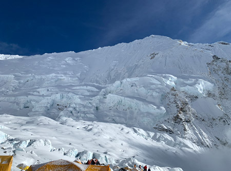
- Experience glacier and snow climbing at high altitude
- Make an early-morning summit attempt on Island Peak
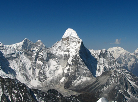
- Enjoy panoramic views of Lhotse, Nuptse, Ama Dablam, Makalu, Baruntse, and surrounding peaks
- Return through the Khumbu Valley to Namche Bazaar and Lukla
About the Island Peak Climbing
Island Peak Climbing is an all in one trekking and mountaineering package that leads the climbers through the heart of Khumbu region as well as to the summit of Imja Tse, commonly and locally known as Island peak. This mountain has been named in English by the early explorers who saw it standing like an island in a sea of ice with the glacial valley of Chukung and Imja lake.
The trek is completely in the Sagarmatha National Park, which is also a UNESCO World Heritage Site that also serves as a home of Mount Everest, Lhotse, Ama Dablam and many other big mountains. The hike takes the same route of the Everest Base Camp trekas far as Dingboche and then heads east to the base of Island Peak, instead of north to Everest Base Camp and Kala Patthar.
A few practical facts define the trip:
- Trek and climb distance: Roughly 130 to 140 km round trip, covering both the approach trek and the summit day itself
- Duration on the ground: 16 days total, including a Kathmandu rest day before departure and a Lukla weather buffer day
- Highest point reached: 6,189 m at the Island Peak summit
Climbing up Island Peak is not a trek to Everest Base camp. The typical EBC trek is an unaided, high-altitude hike on marked trails and does not require advanced climbing ability, just fitness and acclimatization. Island Peak adds a true mountaineering element to this trekking experience, climbers cross a glacier and then ascend a high snow and rock face with a fixed rope, ice axe, mountaineering harp and crampons to reach the summit ridge. It's often the initial true "peak climb" for many trekkers who are looking to take their trekking experience beyond the level of the walking trek to the more technical terrain, and this is frequently a steppingstone towards larger Himalayan objectives.
Given this technical layer, the climb is more suitable for those who fit into a few categories:
- People who experienced trekking have already been on high altitude treks from 4,000 to 5,000 m and are looking for a new activity.
- People with a certain level of mountaineering experience who want a supported moderate climb introduction to Himalayan peak climbing.
- Individuals who can train with a guide first and are physically fit and willing to prepare specifically for their expedition to altitude and basic movement in the mountains, including those lacking technical experience.
Not recommended as a first Himalayan trek for a person with absolutely no experience. Generally, it is not recommended for a person who has never walked at high altitudes at all as it restricts the acclimatization and technical climbing in a very compact manner.
Island Peak Climbing Duration & Distance
The usual trip from Kathmandu to the destination lasts 16 days, although it may be slightly different depending on operator and the number of rest/buffer days included.
A rough breakdown looks like this:
- Kathmandu to Lukla to Namche Bazaar:This 3-day hike from Kathmandu to Lukla to Namche Bazaar takes a gradual ascent from 2860m to 3440m.
- Acclimatization in Namche:1 day (high walk to Everest View Hotel 3880 m)
- Namche to Dingboche:trekking for 2 days through Tengboche and Imja Valley up to 4,410 m
- Acclimatization in Dingboche: 1 day, with a climb toward Nagarjun Hill at around 5,100 m
- Dingboche to Island Peak Base Camp: This is a 2-day route from Dingboche to Base Camp of Island Peak (5,100 m) passing through Chukung (4,730 m).
- Summit day:1 single long day of approximately 14 hours of pushing, starting near midnight.
- Return back to Lukla:(2 days) retracing the trail through Pangboche, Tengboche and Namche
- Buffer and rest days:1 day in Lukla for flight delays and rest day in Kathmandu prior to departure
The number of trekking hours per day can significantly differ depending on the terrain and the ascent of the day. Both walks take about 3-4 hours of easy walking and the climb to Namche Bazaar and descent from Chukung to Namche take 6-7 hours of more challenging walking. The Summit Day is by far the longest, most intense day of the trip, with a night start, technical glacier travel and a long descent back down to Chukung at night.
Variations are possible and can be discussed with your guide/operator:
- Including an additional acclimatization day (especially for trekkers who have not spent time above 4000m previously)
- The construction of a second buffer day in Lukla during unstable weather seasons.
- Reducing the speed of the walk from Namche to Dingboche, by making it two shorter ones instead of one longer one
- For anyone wishing to see both, an extended journey with an optional day visit to Everest Base Camp or Kala Patthar.
Climbing Preparation at Island Peak Base Camp
Reaching Island Peak Base Camp marks, the beginning of the technical section of the adventure.
After arriving at Base Camp, you have time to rest and prepare for the summit attempt. Your climbing guide will provide practical instructions and explain how to use the equipment required for the climb.
Depending on the conditions and your experience, preparation may include:
- Proper use of crampons
- Ice axe handling
- Harness fitting
- Carabiner and rope techniques
- Ascender and descender use
- Movement on fixed ropes
- Basic glacier travel techniques
- Climbing on snow and steep terrain
- Safe movement as part of a climbing team
- Summit-day safety procedures
This preparation is particularly valuable for climbers who have limited previous experience with Himalayan peak climbing.
Island Peak should not be treated as an ordinary trekking destination. The altitude, cold, steep terrain, and changing mountain conditions require physical fitness, proper equipment, and disciplined decision-making.
Island Peak Climbing Difficulty Level
Island Peak Climbing is in the difficulty range of a normal teahouse trek but not a Himalayan expedition. It involves high altitude trekking, which must be done with a high level of commitment, as well as one day of real technical climbing, which must be done with a high level of commitment too.
Physical challenges are important. The days at altitude are long, both days at trekker place are over 15 km as they trek to Dingboche and come back from Chukung to Namche above 3000 m. In addition to the climb up to Summit, which takes about 1100 m, the descent on Summit Day takes another long descent and the living conditions are at about 50% sea level oxygen.
The technical challenge is moderate, but genuine. The climbers should be familiar with:
- How to use crampons on snow and ice.
- Basic glacier travel including roped travel across crevassed terrain
- Basic glacier travel, including roped movement across crevassed terrain
- Steep snow slopes close to the summit ridge up to 40 to 50 degrees at times.
Technical climbing qualifications are not required, but there is a short pre-climb training session at Base Camp, which includes rope work and crampon technique, and should not be omitted.
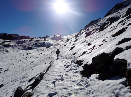
The routes have different conditions throughout the season and from one part to another. The lower sections from Phakding, Namche and Tengboche follow established trekking routes which are very busy. The ground is rockier and more exposed as you approach Base Camp with traversing glacial moraine above Chukung. The path to the summit itself traverses an active glacier, and weather and ice conditions may vary from year to year and even week to week in response to snowfall and glacier movement.
This climb should not be attempted by:
- People with no previous experience hiking above 3500–4000 m
- Without medical clearance those who have been diagnosed with a cardiac, respiratory or other condition which is worsening by altitude.
- Trekkers who are unwilling or unable to do pre-trip fitness activities such as cardiovascular and strength training
- Persons who are not comfortable with exposure, steep terrain or roping to other climbers
Island Peak is also more technical than Mera Peak, which is a non-technical trekking peak with a relatively easy approach to the summit and no technical fixed rope climbing. In contrast, Pisang Peak is primarily rock climbing and scrambling, and is generally considered to be somewhat more demanding than Island Peak. In that range, Island Peak falls somewhere between Mera and Pisang: harder than Mera, but not quite as hard as Pisang, and practically everyone who climbs it is looking for their first real taste of roped glacier and snow climbing.
Altitude & Acclimatization on Island Peak Climbing
Altitude will be the most critical danger during this trip, even if one takes into consideration only technical challenges of climbing itself. It is impossible to overlook the staged character of the route but there should be understanding of this phenomenon and respect for it.
Some key altitude marks on this route will be as follows:
- Lukla, the starting point: 2,860 m
- Namche Bazaar, the first major acclimatization stop: 3,440 m
- Dingboche, the second major acclimatization stop: 4,410 m
- Island Peak Base Camp, the highest sleeping altitude: 5,100 m
- Island Peak summit, the highest point reached: 6,189 m
Difference between highest sleeping altitude and the highest reached point is very significant, about 1,090 vertical meters and it will be accomplished overnight. It is an unusual altitude profile which makes two days of acclimatization crucially important.
Namche acclimatization day is based on the well-known "climb high, sleep low" strategy: trekkers are walking to the Everest View Hotelat 3,880 m, sometimes to the Khumjung village, and then returning to lower altitude at 3,440 m to sleep. The same scheme works in case of Dingboche acclimatization day, when they are going towards Nagarjun Hill at approximately 5,100 m and returning to sleep at 4,410 m. Purpose of both days is the provocation of body's physiological reaction to altitude but not additional risks due to higher altitude of sleep.
Acute Mountain Sickness (or AMS) will be the main problem at elevations higher than 3,000 m. Typical symptoms of AMS are as follows:
- Persistent headache
- Nausea or loss of appetite
- Fatigue beyond what normal exertion would explain
- Dizziness or difficulty sleeping
- In more serious cases, confusion, loss of coordination, or shortness of breath at rest
Mild symptoms are quite usual and can be treated with appropriate measures such as rest, hydration and slow pace. Symptoms like confusion, ataxia or difficulty with breathing during rest may be a sign of medical emergency.
It is essential to have professional guidance at such altitude levels. Guides have experience in tracking the symptoms of group members, enforcing the pace (the "walk slowly" principle that inexperienced trekkers usually underestimate), carrying necessary medications and oxygen (if required) and making decision on return of some climber. That is one of the most important reasons why it is strongly recommended not to climb Island Peak on your own or with unlicensed operators.
Island Peak Climbing Permits & Regulations
Climbing Island peak is not a straightforward permit situation, as several permits are required for the climb, and the usual and practical way of obtaining these permits is through a licensed agency.
Generally, necessary permits will include:
- Entry permit to Sagarmatha National Park (checked at park gate near Monjo) is required for everyone entering the Sagarmatha National Park irrespective of their destination.
- Khumbu Pasang Lhamu Rural Municipality entry fee, collected in the local region of the Khumbu.
- Island Peak Climbing Permit (for Imja Tse), a permit issued specifically for climbing Imja Tse which is not a part of the standard trekking peaks and requires climbing permit from Nepal Mountaineering Associationor concerned government authorities as per the current regulations.
The fees and issuing authorities may vary and travelers are advised to check actual fees and requirements with the licensed trekking agencies or Nepal's tourism authorities before booking, and not on outdated published information.
Convenience isn't the reason licensed guides and registered agencies are important. The licensed operator must ensure that all the necessary permits have been obtained beforehand, must carry the required documents on the trek, must use certified climbing guides on the technical part of the trek, and must adhere to safety and insurance procedures outlined by the Nepalese tourism and mountaineering bodies. The climbing permit process, which also involves rescue and insurance coordination in the event of an emergency, presents a meaningful safety gap and legal risk if the climb is done without a license or if a climber tries to make the climb without a permit.
Best Time to Do the Island Peak Climbing
Season has a direct effect on both trekking conditions and summit day safety, given the glacier travel involved.
Spring (March to May)
It is the first main season of the two climbing seasons. Weather is mild, there is good visibility and the path has a consistent number of trekkers and climbers. The trekking is enhanced by additional blooms of rhododendron forests on the lower parts of the trail too, through points such as Tengboche and Deboche.
Autumn (September to November)
It's the other major season and frequently the best time for sunny mountain vistas and predictable weather. The skies are usually clear in the post monsoon period, the trails are in good condition, and it is usually a very busy time on the Everest region trails with teahouses and Lukla flights in demand.
Winter (December to January)
This is possible but poses some extra difficulties. High camp and summit day can be cold, maybe icy on the trails above Dingboche and may have limited operations at higher teahouses. Winter climbs are typically made by well-equipped, cold-weather climbers.
Monsoon season (June to August)
This is the riskiest and not recommended for this climb. There is a risk of landslides and leachy trails with heavy rain down the trail and it is very difficult to see with cloud cover at altitude. Snowfall from the monsoons and more favorable conditions on the glacier lead to an increased crevasse hazard and make a summit day more hazardous and variable. Also, Lukla flights have a greater likelihood of experiencing delays during this time due to weather.
These seasons,spring and autumn, have the highest level of crowds, both on the trail and the mountain, which is a positive because of all of the teahouse infrastructure and the trail-breaking on the glacier, but also a negative because you'll need to book in advanceif you want a flight or a spot at the teahouse!
Safety Measures & Risk Management on Island Peak Climbing
Safety on a trip like this is all about the protocol, the guide skills and the planning that takes place as well as being applied throughout the day from day one in Lukla to the summit push and back.
Experience and guide certification are the basic. Climbing guides should be qualified in mountaineering and have firsthand, repeated experience on this route because the conditions of the glacier and the fixed ropes change with the seasons. A good guide team is usually a lead climbing guide, several Sherpa to carry the technical load and porters or yaks to carry the lower days' loads.
High-altitude safety protocols that a well-run trip should follow include:
- A well planned and systematic acclimatization programme including special climb high, sleep low days and rest days
- Daily observation of group members for signs and symptoms of AMS, especially above 4,000m
- Vital pre-climb session at Base Camp on crampon use, ascending and descending ropes and basic self-arrest awareness at Base Camp.
- With a turn round policy that is agreed by the guides at the summit and each group, and where the guides set a hard time limit for descent, regardless of how close to the top the group is, to avoid descending on the technical section in deteriorating conditions or darkness
- Bringing the necessary emergency oxygen and basic medicines for high altitude portions
Emergency evacuation planning is a must for any serious operator's safety program. This is usually done by establishing that the client is properly covered by travel and rescue insurance, has communications gear that can alert rescue coordination from remote areas of the route and has an agreed plan of action for descent and evacuation in the event of severe AMS, HAPE, or HACE.
Communication and logistics are not only vital in an emergency, but all year round. Operators maintain communication with the trekking party, with the staff at the base camp and with their office in Kathmandu throughout the trek, and they also arrange the timing of flights to Lukla based on the weather (a buffer day is added into most routes because of this) and the food, water purification and rest time requirements of each day's ascent.
There are four elements to the risks on Island Peak that combine to make such climbs an expert proposition: altitude, weather, glacier conditions and technical climbing movement. None of these risks are extreme on their own when properly managed, but they add up fast without a team of experienced decision makers operating on the ground and reacting to what is happening in real time.
Island Peak Climbing Route & Map
This trek goes through the valley of the Dudh Koshi River starting at Lukla and ending at Namche Bazaar, the classic entry point to the Everest region. The trail winds through the forest along the side of the hills to reach the largest monastery of the Khumbu at Tengboche then crosses the Imja River up to the alpine zone around Pangboche and Dingboche.
After Dingboche the path takes a different character. The route to the Island Peak takes a turn east into the Imja Valley, passing through more and more stony glacial terrain, leading to the village of Chukung rather than continuing north to Everest Base Camp. The trail then passes through glacial moraine at the valley edge of the Imja Lake to reach Island Peak Base Camp right under the north face of the mountain.
On Summit Day, this continues on the glacier of the mountain, with the use of ropes on crevassed areas leading up to a steep headwall protected by fixed ropes and then onto the narrow summit ridge and Imja Tse at its summit.
The Dudh Koshi River and a system of suspension bridges near Namche, the Imja River near Pangboche and the Imja glacier system and Imja lake system that dominate the landscape around Chukung and Base Camp are key natural features along the way.
Villages & Local Life on the Island Peak Climbing
The trekking part of this walk goes through some of the most important Sherpa villages of the Khumbu.
- The commercial center of the region is at Namche Bazaar (3,440 m) where teahouses, gear shops, bakeries and markets are open on Saturday attracting traders from neighboring villages.
- Tengboche (3,860 m) is renowned for its monastery, the largest of the Khumbu, and its rich history with Sherpa Buddhist culture and mountaineering.
- At 4,410 m, Dingboche is in a splendid alpine setting amongst many peaks, such as Ama Dablam, and is an important resting and acclimatization point on both Island Peak and Everest Base Camp routes.
- Khumjung, which is frequently visited on the Namche acclimatization day, is a more peaceful village and has its monastery and a rich Sherpa mountaineering history.
The entire trek is rich with Sherpa culture, whether in the trail markers with prayer flags and mani stones or in the more than a century-old teahouses, many of which are family-run. The guides and porters on these routes are often members of Sherpa communities within the Khumbu region, who have firsthand knowledge of the terrain, weather and mountain conditions that extends beyond any guidebook.
Accommodation & Food on the Island Peak Climbing
Character of the accommodation changes with the ascent. Lower and mid-elevation villages, such as Phakding, Namche, Tengboche, and Dingboche employ the classic Khumbu teahouse system - simple guesthouses with twin-share rooms, shared bathroom facilities (most of the time), and a common dining room that serves as the social nucleus of the evening. The journey continues in tented camping mode at Island Peak Base Camp because there is no teahouse facility at this altitude.
Room types and facilities are generally simple and straightforward as a rule:
- Rooms with twin beds and bedding, but a good sleeping bag is recommended if things go south
- Shared squat or western style toilets and hot showers at a small charge in larger villages such as Namche
- Less reliable charging and Wi-Fi services, typically provided at an additional cost, at higher elevations.
The availability of food is similar. Lower down the menu, western dishes are available; higher up the menu is more limited to simple, easy-to-digest, and calorie-dense foods like dal bhat, noodle soups, porridge and tea. Dal bhat is a staple for trekking, as it is an easy food to find and is very filling, and it's usually offered for free on long days of trekking, which is very helpful.
Planning for hygiene and food safety deserves to be planned for intentionally. Always use water purified with tablets, filtered (or boiled and then cooled) from the water sources and fresh, hot food is safer to eat at high altitudes than raw vegetables or ready-to-eat food.
Flora, Fauna & Conservation Areas
The whole path is set within the borders of the Sagarmatha National Park, a UNESCO World Heritage Site that was set up to protect the unique ecosystem of the high Himalaya and its mountaineering heritage.
There is a dramatic change in vegetation from different elevations. Splendors of spring flowering adorn the lower sections near Phakding and below Namche pass through pine and rhododendron forest. Higher than Namche the forest becomes sparse where trees are replaced by juniper and dwarf shrub, and above about 4000 m this is replaced by alpine ground with tough, hardy plants, that are less competitive in the cold and thin air.
Some of the animal life found in the park includes the Himalayan tahr, musk deer and, at higher and more remote altitudes, the elusive snow leopard, as well as many high-altitude birds such as the Himalayan monal, which is the national bird of Nepal.
Responsible trekking practices matter for preserving this environment for future visitors:
- Implementing non-biodegradable waste collection without depending on the limited collection infrastructure in remote villages
- Where possible using boiled and/or filtered water rather than single use plastic bottles.
- Avoiding damage to delicate alpine plant life by staying on designated trails
- Being sensitive to the animals seen in the course, keeping distance and never feeding them
- Supporting local and community-based teahouses and guide services, directly linking conservation incentives to sustainable tourism
Island Peak Climbing Packing List
The packing list is just as important as it is for comfort on the non-summit days of the trip as well as on summit nights, when temperatures can fall below freezing.
Clothing:
- Base layers (light and midweight, moisture wicking)
- On the evening of the summit day, it is recommended to wear an insulated down jacket.
- Rip-off-proof, windproof outer shell pants and jacket
- Trekking trousers for days at lower elevations.
- Warm hat, sun hat and buff or neck gaiter.
- Insulated gloves with thinner liner gloves
Footwear:
- Rugged, worn hiking boots for the approach hike.
- Summit day boots with insulators and crampons
- Warm wool or synthetic trekking socks – several pairs
- Hiking boots or sandals for night at teahouses
Gear:
- A climbing harness, crampons, ice axe (if necessary) and helmet (which can be rented in Kathmandu or Namche)
- Ascender and descending device, normally supplied and/or set-up by the operator
- Headlamp (with extra batteries), needed to start the summit at midnight
- A sleeping bag that is designed to be used in high altitudes during the four seasons.
- Daypack for trekking days, plus a duffel bag for porter-carried gear
Documents:
- A valid passport with an adequate number of valid days and spare passport photographs.
- Nepal visa
- necessary permits (through the trekking agency)
- Travel and rescue insurance (high altitude, helicopter evacuation) documentation
Optional vs essential items
I believe that some items are optional, some essential, and some are non-negotiable. Non-negotiable at Base Camp and on summit night are technical climbing equipment, cold weather clothes, and a good sleeping bag. A portable charger, trekking snacks from home or a personal first aid kit not included in the group kit is acceptable as an optional comfort item as most agencies will have this as part of the group kit.
Island Peak Climbing vs Other Popular Peak Climbing
Island Peak Climbing vs Mera Peak Climbing
Mera Peak is technically easier with a fairly straightforward approach to the summit that is mostly non-technical and also not very exposed but is at a higher altitude of over 6400 m. Contrast this with Island Peak, where more sustained technical climbing is required on the summit headwall rather than just a high point, is more suitable for those who are specifically interested in practicing rope and crampon climbing skills.
Island Peak Climbing vs Pisang Peak Climbing
Unlike the Khumbu, Pisang Peak is in the Annapurna region, and generally requires more rock scrambling than Island Peak and is a little more technically challenging. It is frequently selected by those with some experience at the summit of Island Peak who wish to take a step up.
Island Peak Climbing vs Pikey Peak
It is a trip of an entirely different nature, a lower altitude trekking peak (approx. 4065 m) without any technical climbing whatsoever; it is very popular and it is a shorter trek (with a view of the Everest range). It is a fair option for those who wish to experience the Khumbu without being challenged technically and at altitude.
Who should choose Island Peak Climbing
For those who desire a genuine and technical mountaineering objective within a two-to-three-week trip who are comfortable with roped glacier travel and steep snow terrain who have either previous high altitude trekking experience or are willing to train as a climber and as an altititude+glacier traveler before departure.
Is the Island Peak Climbing Suitable for Beginners?
The straight answer is that it will depend quite a bit on what you consider to be a beginner. A person who is new to technical climbing but has a good level of trekking fitness and has already spent some of their time above 3,500 to 4,000m should be able to do Island Peak, if properly guided and prepared. A person with no experience at all in trekking or altitude has a significantly greater risk profile and should acquire experience on a more basic trek first.
Fitness emphasis will be cardiovascular endurance and leg strength, as it will be several consecutive days of 5 to 7 hours of walking at altitude followed by a challenging 14-hour summit day. The starting point for training is a minimum of several months of regular hiking, running or cycling, and a minimum of some stair climbing with a loaded pack, plus, ideally, one trip to altitude above 3,000 m (hiking or trekking) to assess individual acclimatization to altitude.
Pre-trip training should involve learning to use crampons, basic rope ascending and descending and how to move safely on a fixed line and should include a pre-trip introduction (even a brief introduction) to these skills, ideally not just during the one Base Camp briefing in Nepal. Knowing how to fit a harness and how to use basic mountaineering equipment will help to take away a great deal of stress on the night of the summit!
Realistic suitability assessment, Island Peak Climbing is a real accomplishment for the motivated, physically capable beginner in technical climbing, provided he takes the altitude seriously and follows the instructions of the guide closely on the ascent and knows not to underestimate the demands of summit day. It is not, however, a hike to be taken lightly or without careful preparation, when you consider the altitude involved, the cold and the difficult terrain.
Why Choose Mountain Ram Adventures for Island Peak Climbing
An agency's selection as the operator impacts almost every one of the safety and legal considerations listed above, it's a good idea to look at an agency based on some solid standards, not just some sales jargon.
- Legal requirements:A registered agency ensures all permits are obtained before the trip (national park, local area and the specific Island Peak climbing permit) and will take the necessary documentation on the trip.
- Safety implications:When working with licensed and experienced climbing guides, the individual working at the summit will be monitoring the altitude, there will be a proper turnaround on the summit day and there will be a coordinated approach to emergency evacuation plans with appropriate insurance in place for the client.
- Local expertise:Guide and support staff from Sherpa communities who have first-hand experience and repeated experience of this route, the glacier conditions in this region and the acclimatization requirements.
- Sustainability:By supporting a locally based operator, trekking and climbing proceeds within the local communities of trekking routes, from the teahouse owners to the porter and guide, and is directly related to the conservation objectives of Sagarmatha National Park.
Trip Itinerary Expand All
- None included (Breakfast if arriving early)
- ,400 m (Kathmandu)
- Hotel (Kathmandu)
Upon arrival in Kathmandu, you will be picked up at the airport and driven to your hotel, and the rest of the day will be at your leisure. A pre-trek briefing is held in the evening, explaining the trek and its challenges to the group, including altitude and a final gear check; any items that are not discussed at this time can be acquired from the trekking shops in Thamel before departing.
- 3 hours
- Breakfast, Lunch, Dinner
- 2,610 m (Phakding)
- Teahouse / Hotel (Phakding)
From there a short domestic flight takes off to arrive at Tenzing-Hillary Airport at 2,860 m, which is one of the more dramatic runways in commercial aviation. From here, the trail descends past pine forest along the Dudh Koshi River, and through the traditional Sherpa homestead where life continues at a leisurely pace. This is a walk to Phakding, a small village on the banks of the river which is so convenient for the first night of the trail.
- 6 hours
- Breakfast, Lunch & Dinner
- 3,440 m (Namche Bazaar)
- Teahouse / Hotel (Namche Bazaar)
The path passes through Toktok (2,760 m) and Monjo (2,835 m) and the entrance gate to Sagarmatha National Park is the first point of check for permits on this trek. From Jorsalle (2,740 m) (usually lunch point) the trail follows several suspension bridges (one is the high Hillary Bridge) and then a steep, sustained ascent through pine forest to Namche Bazaar. At 3,440m, Namche is the commercial and cultural centre of the Khumbu and is situated in a natural bowl with teahouses, gear shops and bakeries.
- 3–4 hours (round trip)
- Breakfast, lunch and dinner
- 3,880 m (Everest View Hotel) / 3,440 m (Namche Bazaar)
- Teahouse / Hotel (Namche Bazaar)
Today's hike is not a "rest day" but a high to low hike that allows the body to acclimatize much better than sitting still. Following the trail up to the Everest View Hotel at 3,880 m, one of the highest hotels in the world, where on a clear morning you can see the first real sight of Everest, Lhotse and Ama Dablam. Many groups continue beyond to the more untouristy village of Khumjung at about 3790m which is the home of the monastery and has been a notable landmark in Sherpa mountaineering history before returning to Namche for the night.
- 6 hours
- Breakfast, lunch and dinner
- 3,860 m (Tengboche)
- Teahouse (Tengboche)
Leaving Namche, the trail hugs the hillside, steadily approaching the high peaks. Descends through the forest to Phunki Tenga, a small riverside town at 3,250 m where a teahouse is located within earshot of the river before ascending steadily to Tengboche at 3,860 m. Tengboche has the biggest monastery in the Khumbu and provides excellent views of Everest and Nuptse from the monastery courtyard, with time often available to enjoy these views in the evening.
- 6 hours
- Breakfast, lunch and dinner
- 4,410 m (Dingboche) / 5,100 m (Nagarjun Hill)
- Teahouse (Dingboche)
The trail descends through rhododendron forests to Debouche before crossing the Imja River and climbing toward Pangboche. From here, the landscape opens into alpine terrain as you continue through the Imja Valley to Dingboche, surrounded by Ama Dablam and other towering peaks.
- 4 hours
- Breakfast, lunch and dinner
- 4,410 m (Dingboche) / 5,100 m (Nagarjun Hill)
- Teahouse (Dingboche)
Today is dedicated to acclimatization in Dingboche, with a gradual hike toward Nagarjun Hill at around 5,100 m. The climb offers impressive views of Ama Dablam, Makalu, and the surrounding Himalayan peaks before descending back to Dingboche. The afternoon is free to rest, recover, and prepare for the higher section of the Island Peak adventure.
- 2 hours
- Breakfast, lunch and dinner
- 4,730 m (Chukung)
- Teahouse (Chukung)
The scenery turns noticeably rawer on this short leg, as the trail crosses the cracked, stony floor of the Chukung Valley. Ringed by an amphitheatre of giants, Lhotse, Nuptse, Ama Dablam, and Island Peak, Chukung sits at 4,730 m. Because the walk is short, the extra time is well spent resting, hydrating, and mentally preparing for the climb ahead.
- 3 hours
- Breakfast, lunch and dinner
- 5,100 m (Base Camp)
- Tented Camp (Base Camp)
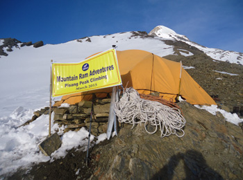
Leaving Chukung, the trail crosses high glacial moraine and rocky terrain along the edge of the Imja Lake valley on the way to Island Peak Base Camp, at 5,100 m. Once tents are set up and gear is checked over, the rest of the day is kept deliberately quiet, since the group will be woken up well before midnight for the summit push.
- Breakfast, lunch and dinner
- 6,189 m (Island Peak Summit) / 4,730 m (Chukung)
- Teahouse (Chukung)
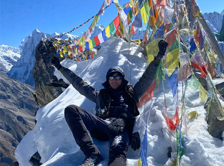
The summit attempt starts around 11:20 PM the night before, with the group roped up and moving by headlamp across the glacier. The route climbs nearly 1,100 vertical meters through rock scrambles, fixed ropes, and steep snow slopes before reaching the summit of Island Peak (Imja Tse) at 6,189 m, usually around sunrise. After taking in the views, and celebrating a genuinely hard-earned moment, the group rappels back down to Crampon Point and Base Camp, then continues on foot to Chukung for a well-deserved rest.
- 7 hours
- Breakfast, lunch and dinner
- 3,440 m (Namche Bazaar)
- Teahouse / Hotel (Namche Bazaar)
With the summit behind you, the long walk down begins. The trail retraces familiar ground through Pangboche (3,985 m) and Tengboche (3,860 m), and the air noticeably thickens with every hour of descent. By the time Namche Bazaar comes into view at 3,440 m, the bakeries, hot showers, and wider food choices feel like real luxuries after days spent above 4,700 m.
- 6–7 hours
- Breakfast, lunch and dinner
- 2,860 m (Lukla)
- Teahouse / Hotel (Lukla)
The final trekking day retraces the route from the start, crossing the Dudh Koshi's suspension bridges one last time and passing back through Phakding (2,610 m) before climbing to Lukla at 2,860 m. It's a fitting bookend to the trek, and most groups mark the occasion with a shared dinner alongside the guides and porters who carried gear and looked after the team throughout.
- Breakfast, Lunch & Dinner
- 2,860 m (Lukla)
- Teahouse / Hotel (Lukla)
Lukla flights are weather-dependent, and this day exists to absorb any delay without disrupting the return to Kathmandu or onward international flights. If the weather holds and no delay occurs, it's a free day to relax around Lukla before the flight out.
- Breakfast
- 1,400 m (Kathmandu)
- Hotel (Kathmandu)
An early flight out of Tenzing-Hillary Airport carries you back to Kathmandu, with one last aerial view of the Himalayan foothills before the descent into the valley. Landing back in Kathmandu at 1,400 m, the rest of the day is free to rest, shower properly for the first time in weeks, and enjoy a celebratory dinner in Thamel.
- Breakfast
With no activities scheduled, this day is built around your outbound flight. Depending on timing, there may be a few free hours for a stroll around Thamel before transferring to Tribhuvan International Airport for departure.
An elevated point of 5416m. You will be mountain climbing in the main on well established trails. Come and join a Great adventure trip.
Trip Video
Frequently Asked Questions Expand All
There are no official requirements, but previous experience of high altitude trekking and some basic training before departure in crampon and rope skills are highly recommended.
On summit nights temperatures often fall below freezing, especially near the summit ridge in the pre-dawn hours and a suitable four-season sleeping bag and full cold-weather clothing are essential.
Of course, you can find operators who have the option of doing an extra day or two to visit Everest Base Camp or Kala Patthar before or after the Island Peak section, which will take you several days beyond the 16-day itinerary.
That's why it is a basic feature of a standard tour, that they have a buffer day, if there is a good chance that the weather will clear in that window, then the journey will proceed as planned, and more experienced operators will have plans for longer delays in case the weather does not clear.
Yes. Trekking and/or climbing insurance up to 6,000m and to helicopters is considered essential and is normally compulsory by licensed operators before departure.
Crampons, harness, helmet, ascender, descender, carabiners, gaiters, warm clothes, gloves, a headlamp and other high elevation equipment are essential equipment.
Yes. There are two acclimatization days; one in Namche Bazaar and the other in Dingboche. These are required stops en route to Chukung and the Base Camp of Island Peak.
This is a full day event and starts at about midnight at the summit. It really depends on weather, trail conditions, speed and ability of the participants.
The views of Everest and numerous other peaks of the Himalayas are spectacular in the Island Peak region. It is also an outstanding panorama to the surrounding mountains in the Khumbu region.
The hills weather is always capricious. If conditions do not seem safe and/or sufficient time is not available, the climbing team may modify the plans for the summit attempt, or cancel it. Safety should always come first, and a summit should never be the priority.
If you want to do some peak climbing in the Himalayas, but don't want to go on an expensive big expedition, then Island Peak is a challenging and satisfying peak to climb. This trek involves trekking at high altitudes, preparation for climbing, glacier and snow travel along with being able to stand at 6189 meters above sea level.
Good preparation and sound guidance are more important for Island Peak Climbing than physical strength. With a properly constructed plan, acclimatization, certified climbing guides, and proper safety measures, a well-planned goal can be an achievable and well-managed adventure, not an unnecessary gamble.
When considering whether this climb is a good fit for your experience level and time frame, the information above, on difficulty, altitude, permits, and preparation, is a good place to begin the discussion with a licensed operator. From there a sufficient briefing over the trip, your equipment and background training will tell you much more than any general guide.
| No. of people | Price P.P |
| 1 - 1 | US$ 0 |
| 2 - 6 | US$ 0 |
| 7 - above | US$ 0 |
US$
There will be extra charge for private trips.Talk with
Travel Specialist Ram Sharan Upreti